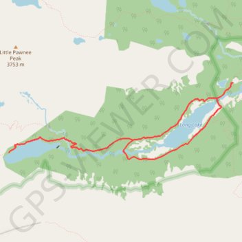
Lake Isabelle and Long Lake Loop
Carte interactive
Profil de la trace GPS
À propos de cette trace GPS
Nom : Trace GPS Lake Isabelle and Long Lake Loop, itinéraire, parcours
Coordonnées : 40.06790 -105.62242 40.07787 -105.58446
Autres traces GPS
Cliquez sur une trace GPS pour visualiser son itinéraire, ses statistiques et son profil.
Lone Eagle Peak - Pawnee Pass
United States > Colorado > Grand County
Lake Ganby, Monarch Lake, Crater Lake, Triangle Lake, Pawnee Lake, Lake Isabelle, Long Lake. Rocky Mountains. #Hike #RockyMountains
Distance : 32,9 Km • Dénivelé positif : 2 006 m • Altitude maximum : 3 824 m