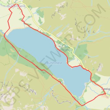
Buttermere - Lake District National Park
Carte interactive
Profil de la trace GPS
À propos de cette trace GPS
Nom : Trace GPS Buttermere - Lake District National Park, itinéraire, parcours
Départ : B5289, Buttermere, Cumberland, England, CA13 9UZ, United Kingdom (54.54131 -3.27599)
Arrivée : B5289, Buttermere, Cumberland, England, CA13 9UZ, United Kingdom (54.54131 -3.27635)
Coordonnées : 54.52159 -3.28019 54.54131 -3.24633
Autres traces GPS
Cliquez sur une trace GPS pour visualiser son itinéraire, ses statistiques et son profil.
Haystack District Lake
Royaume-Uni > Angleterre > Cumberland > Buttermere > Gatesgarth
Vues superbes sur le lac de Buttermere
Distance : 7,2 Km • Dénivelé positif : 476 m • Altitude maximum : 580 m