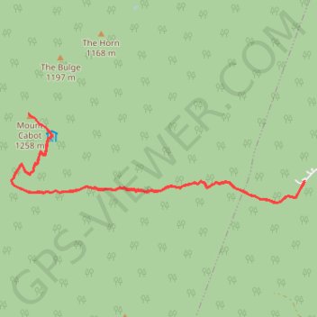
Mount Cabot
Hike to Mount Cabot via York Pond Trail, Bunnell Notch Trail, Bunnell Notch, Killkenny Ridge Trail, Bunnell Rock and Mount Cabot Cabin in the White Mountain National Forest. #Hike #Mountain #Forest #Nature
- Distance : 14,8 Km
- Dénivelé positif : 850 m
- Altitude maximum : 1 260 m
- Dénivelé négatif : 851 m
- Altitude minimum : 507 m
- Temps en mouvement : 4 h 9 m
- Vitesse en mouvement : 3,6 Km/h
- Vitesse maximum : 5,9 Km/h
- Temps total : 4 h 35 m
- Vitesse globale : 3,2 Km/h
- Date : 2023-08-28
Carte interactive
Profil de la trace GPS
À propos de cette trace GPS
Nom : Trace GPS Mount Cabot, itinéraire, parcours
Départ : York Pond Trail, Berlin, Coös County, New Hampshire, United States (44.49666 -71.35891)
Arrivée : York Pond Trail, Berlin, Coös County, New Hampshire, United States (44.49651 -71.35898)
Coordonnées : 44.49350 -71.41816 44.50632 -71.35891
Autres traces GPS
Cliquez sur une trace GPS pour visualiser son itinéraire, ses statistiques et son profil.