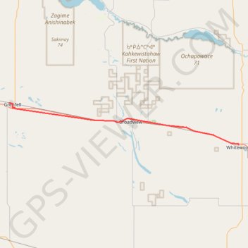
Grenfell - Whitewood
Carte interactive
Profil de la trace GPS
À propos de cette trace GPS
Nom : Trace GPS Grenfell - Whitewood, itinéraire, parcours
Départ : Lake Street, Grenfell, Division No. 5, Saskatchewan, S0G 2B0, Canada (50.41368 -102.93872)
Arrivée : Lalonde Street, Whitewood, Division No. 5, Saskatchewan, S0G 5C0, Canada (50.33487 -102.26686)
Coordonnées : 50.33487 -102.93872 50.41410 -102.26666
Autres traces GPS
Cliquez sur une trace GPS pour visualiser son itinéraire, ses statistiques et son profil.
Indian Head - Grenfell
Canada > Saskatchewan > Division No. 6 > Indian Head
Distance : 55,6 Km • Dénivelé positif : 99 m • Altitude maximum : 610 m