Lake Ann
Carte interactive
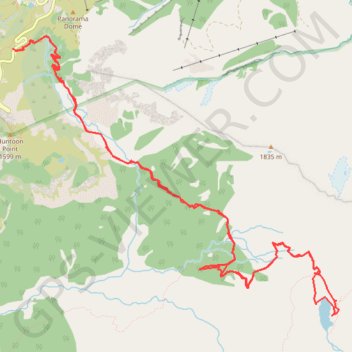
Profil de la trace GPS
À propos de cette trace GPS
Nom : Trace GPS Lake Ann, itinéraire, parcours
Départ : Mount Baker Highway, Whatcom County, Washington, United States (48.85011 -121.68652)
Coordonnées : 48.82655 -121.68652 48.85133 -121.64276
Autres traces GPS
Cliquez sur une trace GPS pour visualiser son itinéraire, ses statistiques et son profil.
Chain Lakes and Wild Goose Trails Loop
United States > Washington > Whatcom County
Loop hike via Bagley Dam, Chain Lakes Trail, Bagley Lakes, Iceberg Lake, Mazama Lake, Wild Goose Trail, Terminal Lake and Heather Meadows in the Mount Baker Wilderness. #Hike #Loop #Lake #Nature #Mountain #River #Forest #Wilderness
Distance : 12,5 Km • Dénivelé positif : 623 m • Altitude maximum : 1 666 m
Northern part of the Pacific Crest Trail (PCT)
United States > Oregon > Klamath County
Hike on the Pacific Crest National Scenic Trail from Crater Lake to Canada Border through Oregon and Washington along the Sierra Nevada and Cascade mountain ranges. #Hike #Mountain #SierraNevada #Cascade #Nature #Forest #Park #PCT
Distance : 1 198,3 Km • Dénivelé positif : 44 308 m • Altitude maximum : 2 307 m